Plot two points, count horizontal and vertical legs, apply a2+b2=c2 and d=(x2−x1)2+(y2−y1)2, compare crow-flight with city-block paths, convert grid units to miles with a scale, and add side lengths for perimeters on the plane, aligned to Grade 8 CCSS 8.G.B.7–8.G.B.8.
What you’ll learn
Main idea: straight-line distance on a grid = hypotenuse of a right triangle whose legs are horizontal and vertical separations.
Build the triangle: move horizontally, then vertically; the right angle is at the corner point, not at A or B.
Show arithmetic in order: square each leg, add, then square root (example: 82=64, 62=36, 64+36=100, 100=10).
Then name legs Δx and Δy; the distance formula d=(x2−x1)2+(y2−y1)2 is the same steps in one line.
Also in this unit: city-block ∣x2−x1∣+∣y2−y1∣, map scale, perimeter sums, round to the nearest tenth at the end.
A research-backed week of short routines that help a student study less and remember more: spacing, self-quizzing, and a calmer week before tests.
Learning acts
Discover
Think about this
Why does squaring coordinate differences give the same result as using absolute values on the legs?
Treat map pins as coordinate pairs: horizontal and vertical separations are legs; the straight segment is the hypotenuse.
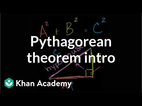
The Pythagorean theorem intro | Right triangles and trigonometry | Khan Academy (10:46)
Learn
Read each section like a formula card: why it matters, the steps, one worked example, then the check. Try the steps yourself before moving to Practice.
Build a right triangle on the grid
How to do it:
1. Plot two ordered pairs on the same grid.
2. Move horizontally from the first point until you match the other x-value, then vertically to the second point.
3. The right angle is at that corner. The hypotenuse is the diagonal from the first point to the second. Count ∣Δx∣ and ∣Δy∣ as the legs, then c=a2+b2.
A (2, 5) and B (10, 11). The crow-flight path is the straight diagonal between them (drawn in later steps).From A, go east to (10, 5), then north to B. Right angle at (10, 5). Leg a = |10 − 2| = 8 (horizontal). Leg b = |11 − 5| = 6 (vertical). Hypotenuse c = 10 is the diagonal from A to B.
Worked example:A(2,5) and B(10,11). Horizontal to (10,5), then vertical to B. Legs a=∣10−2∣=8 and b=∣11−5∣=6. Then 82=64,62=36,64+36=100, so c=100=10 grid units.
Check: the hypotenuse is not the path that turns at the corner. Adding 8+6=14 skips the squares.
Distance formula
How to do it:
1. Name the same legs as Δx=x2−x1 and Δy=y2−y1. Lengths use absolute value.
2. Package the Pythagorean steps:
d=(x2−x1)2+(y2−y1)2
3. If both points share an x (or a y), one leg is zero and d is just the other absolute difference.
Same triangle: |Δx| = 8 and |Δy| = 6 are the leg lengths. Distance d = 10 along the diagonal.Both points share x = 5, so the distance is vertical only: |12 − 0| = 12 units.
Worked example: For A(2,5) and B(10,11):(10−2)2=64,(11−5)2=36,d=100=10. Same triangle, faster notation.
1. When d2 is not a perfect square, keep the radical until the last step, then round once.
2. After grid units, multiply by the map scale to get miles.
3. Crow-flight is the diagonal. City-block is ∣x2−x1∣+∣y2−y1∣. For a polygon, add the side lengths.
Blue path along streets: 8 + 6 = 14 units. Dashed diagonal: crow-flight 10 units.
Worked example: From (0,0) to (4,7):16+49=65,d=65≈8.1 to the nearest tenth. Then 10 units at 0.75 mi per unit is 7.5 miles. Trapezoid (0,0),(8,0),(6,4),(2,4) has perimeter 8+4+5+5=22 when each slanted side is 5.
Check: city-block is not crow-flight. Forgetting the scale, rounding before the square root, or adding legs instead of squaring are the usual map mistakes.
Key points to remember
Main idea: straight-line distance on a grid = hypotenuse of a right triangle whose legs are horizontal and vertical separations.
Build the triangle: move horizontally, then vertically; the right angle is at the corner point, not at A or B.
Show arithmetic in order: square each leg, add, then square root (example: 82=64,62=36,64+36=100,100=10).
Then name legs Δx and Δy; the distance formula d=(x2−x1)2+(y2−y1)2 is the same steps in one line.
Also in this unit: city-block ∣x2−x1∣+∣y2−y1∣, map scale, perimeter sums, round to the nearest tenth at the end.
Practice
Practice what you learned
Apply what you read with the activities below. Use calculators and formula sheets as needed; scored quizzes are in Apply.
Your place saves as you go. Use Back to journey when you are ready to continue the path.
Apply
Apply what you learned
The best check is explaining Distance on the Coordinate Plane in your own words. The tutor listens like a curious friend and asks clarifying questions. No score, no grade.
Explain it in your own words
Explain Distance on the Coordinate Plane as if to someone who has never heard of it. The tutor responds like a curious learner with clarifying questions, not a score.
+Reflection prompts (optional)
Why does squaring coordinate differences give the same result as using absolute values on the legs?
When would a map app show driving distance much larger than the straight-line distance between the same pins?
How is finding distance on the plane similar to finding a ladder length in a right triangle model?
What changes when a map says 1 unit =2 miles versus 1 unit =0.75 miles?
+Optional: scored check
Want a scored check? Open it here. The teach-back above does not require finishing it.
The scored check opens up once you have spent a little time in Learn and Practice. Recall sticks best after you have engaged with the material first.